


 Download the datasheet
 Watch our full workflow demonstration video

Fast, agile and precise 3D reality capture solution.
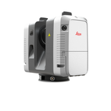
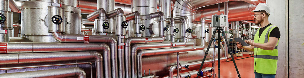
The Leica RTC360 empowers users to document and capture their environments in 3D, improving efficiency and productivity in the field and in the office through fast, simple-to-use, accurate, and portable hardware and software. The RTC360 3D laser scanner is the solution for professionals to manage project complexities with accurate and reliable 3D representations.
Introducing the Leica RTC360 3D Laser Scanner
The Details:
- Measure up to 2 Million points per second
- Colored 3D Point Clouds
- Full Scan in under 2 minutes
- Small and lightweight
- Easy-to-Use one button operation
- Automated Field Registration using Cyclone FIELD 360
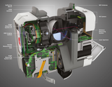
The RTC360 3D laser scanner makes 3D reality capture faster than ever before. With a measuring rate of up to 2 million points per second and advanced HDR imaging system, the creation of coloured 3D point clouds can be completed in under 2 minutes. Plus, automated targetless field registration (based on VIS technology) and the seamless, automated transfer of data from site to office reduce time spent in the field and further maximize productivity.
VIS - Visual Inertial System
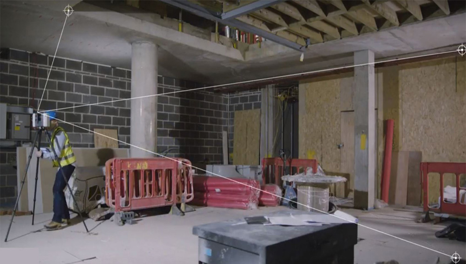
Real Time Registration is automatic point cloud alignment base on real time tracking of scanner movement between setups.
- Highly portable, highly automated, intuitive and designed for maximum productivity, the RTC360 solution efficiently combines the RTC360 a high-performance 3D laser scanner, Leica Cyclone FIELD 360 mobile-device app for edge computing for automatically registering scans in real time, and Leica Cyclone REGISTER 360 office software to integrate your 3D model seamlessly into your workflow
- Capture scans, including enriching High-Dynamic Range (HDR) imagery, in less than two minutes.
- Automatically record your moves from station to station to pre-register your scans in the field without manual intervention.
- Augment your data capture with information tags illustrating the opportunities for better planning, reflect site reality, and boost your teams’ situational awareness.
Fast
The new Leica RTC360 laser scanner makes 3D reality capture faster than ever before. With a measuring rate of up to 2 million points per second and advanced HDR imaging system, the creation of coloured 3D point clouds can be completed in under two minutes. Plus, automated targetless field registration (based on VIS technology) and the seamless, automated transfer of data from site to office reduce time spent in the field and further maximize productivity.
Agile
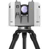
Small and lightweight, the Leica RTC360 scanner’s portable design and collapsible tripod mean it’s compact enough to fit into most backpacks, ready to be taken anywhere. Once on-site, easy-to-use, one-button operation makes for fast, hassle-free scanning
Precise
Low noise data allows for better images, resulting in crisp, high-quality scans that are rich in detail and ready for use in a range of applications. Combined with Cyclone FIELD 360 software for automated registration in the field, the Leica RTC360 scanner offers outstanding precision that can be checked on-site.
Pre-registration in the field
As part of the RTC360 solution, the Cyclone FIELD 360 app links the 3D data acquisition in the field with the laser scanner and data registration in the office with Cyclone REGISTER 360. On-site the user can automatically capture, register and examine scan and image data. The user interface combines easy handling of complex calculations with a graphical user guidance that offers a remarkable user experience, also for novice users.
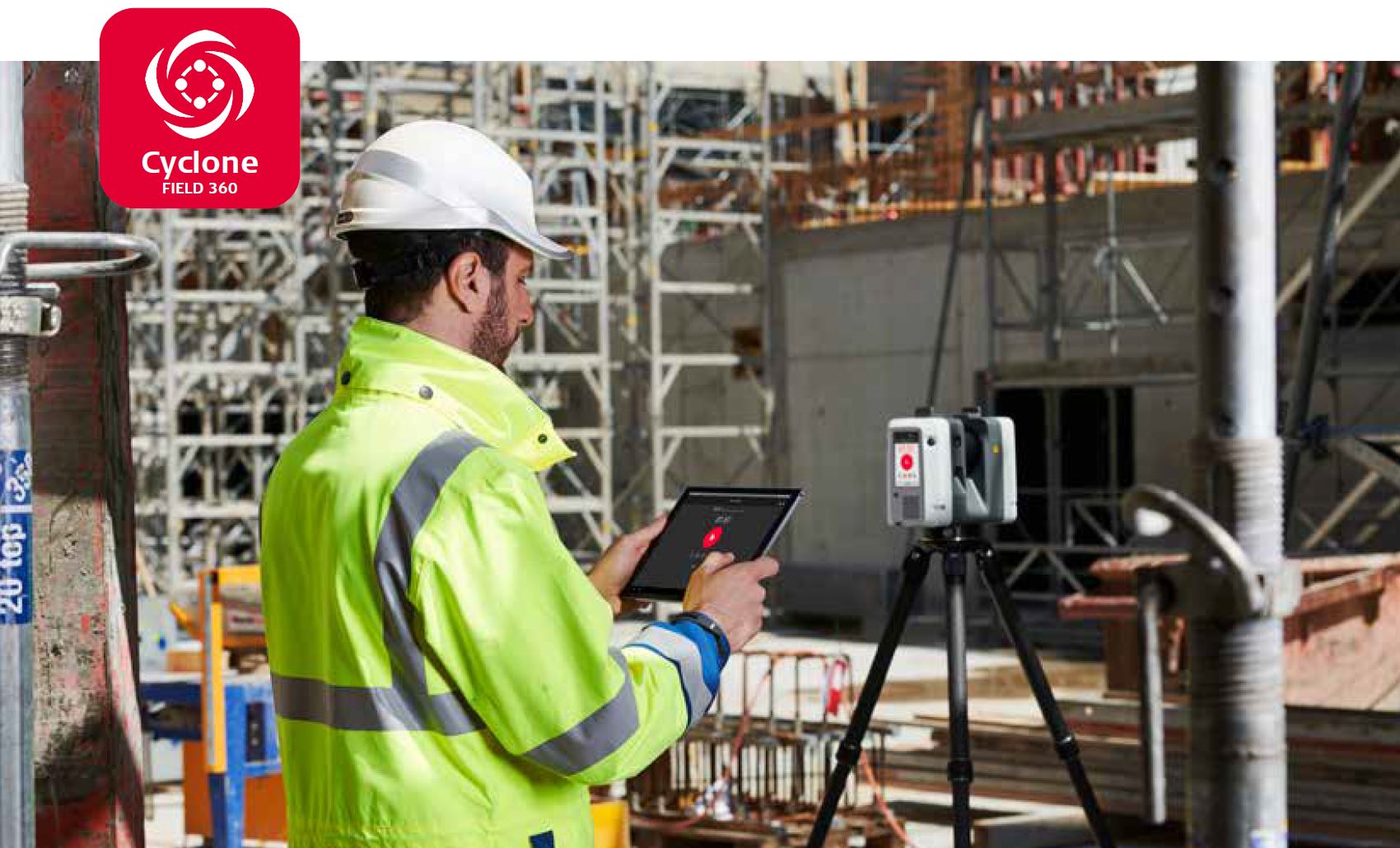
Cyclone FIELD 360
The high-performance Leica Cyclone FIELD 360 mobile-device app is the perfect field companion for the Leica RTC360 3D laser scanner. With its intuitive user interface, remote scanner control and on-site point cloud display, navigation is a breeze - even for novice users – with full imagery and point cloud data delivered directly to the tablet using edge computing technology. 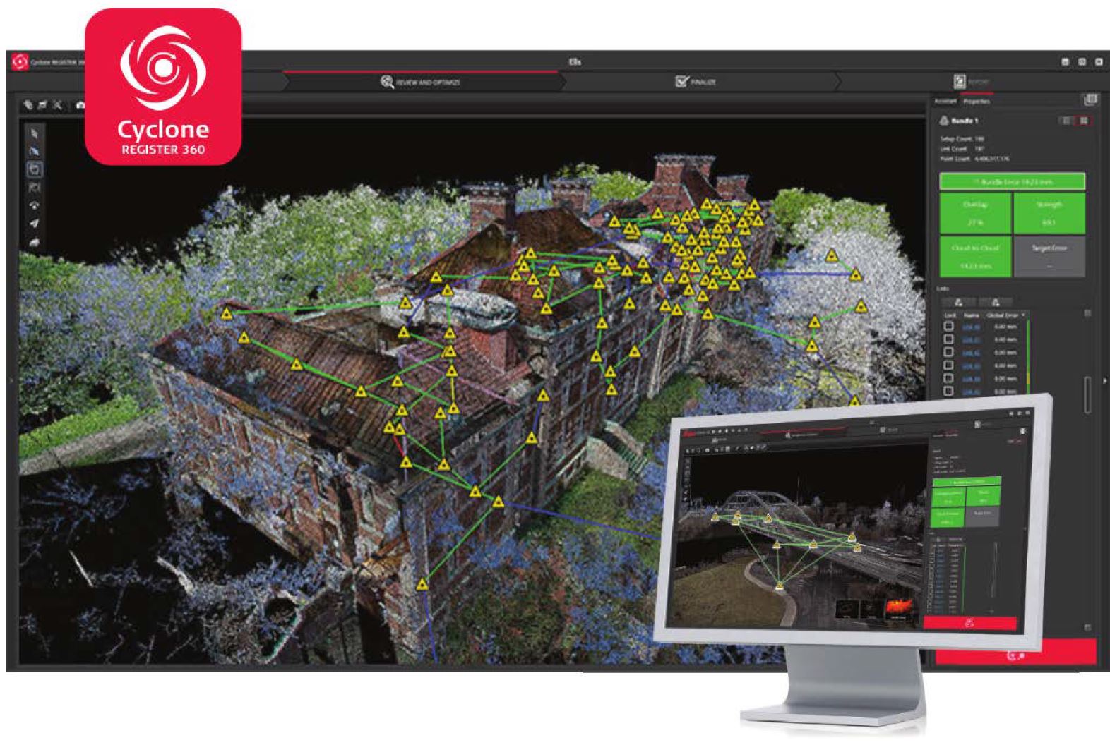
Cyclone REGISTER 360
The RTC360 companion release of Leica Cyclone REGISTER 360 allows for seamless import of pre-registered RTC360 field data. Data import is as easy as drag, drop, done. As no further manual alignment process is needed, excellent results are provided in a fraction of time.
RTC360 data captured in the field is also immediately available in multiple software applications, serving field tags, assets, HDR imagery and 3D point cloud in JetStream powered solutions.

